Datei:Map of USA with state names.png
Größe dieser Vorschau: 800 × 495 Pixel. Weitere Auflösung: 2.560 × 1.583 Pixel.
Originaldatei (2.560 × 1.583 Pixel, Dateigröße: 657 KB, MIME-Typ: image/png)
Dateiversionen
Klicke auf einen Zeitpunkt, um diese Version zu laden.
| Version vom | Vorschaubild | Maße | Benutzer | Kommentar | |
|---|---|---|---|---|---|
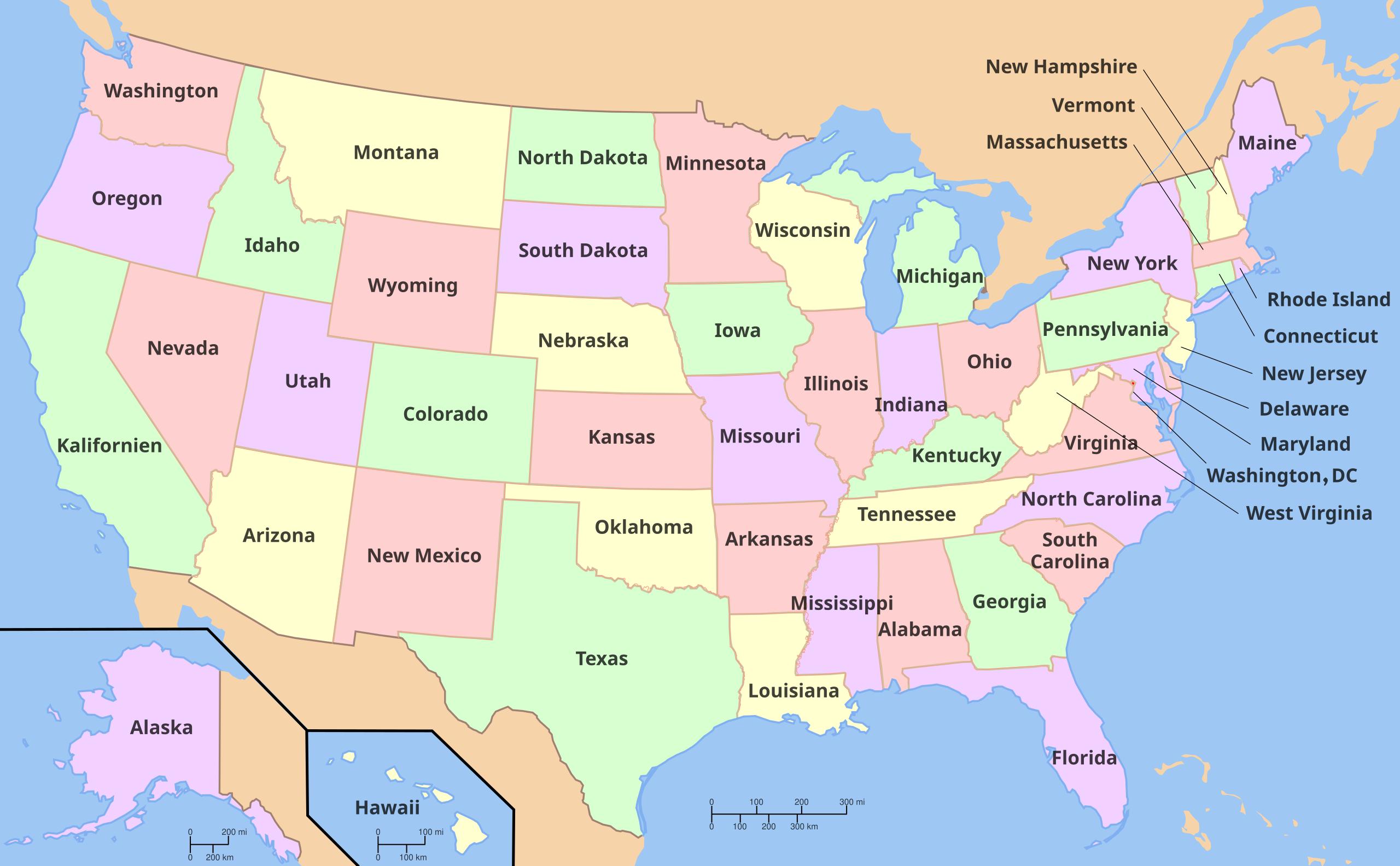
| aktuell | 18:11, 25. Sep. 2024 | | 2.560 × 1.583 (657 KB) | hdrei_images>Anansi | == Summary == {{PictureInfo| | Description = Pictured is a map of the United States with the names of the states. | Beschreibung = Auf dem Bild eine Karte der Vereinigten Staaten mit den Namen der Bundesstaaten. | Descripción = En la foto se muestra un mapa de los Estados Unidos con los nombres de los estados. | Descrizione = Nella foto è una mappa degli Stati Uniti con i nomi degli stati. | Leírás = A képen az Egyesült Államok térképe látható az államok nevével. | Source = [https://d... |
Dateiverwendung
Die folgenden 2 Seiten verwenden diese Datei: